University of Oxford · WildCRU & Department of Computer Science · Funded by NERC

Adding depth to camera trap analyses

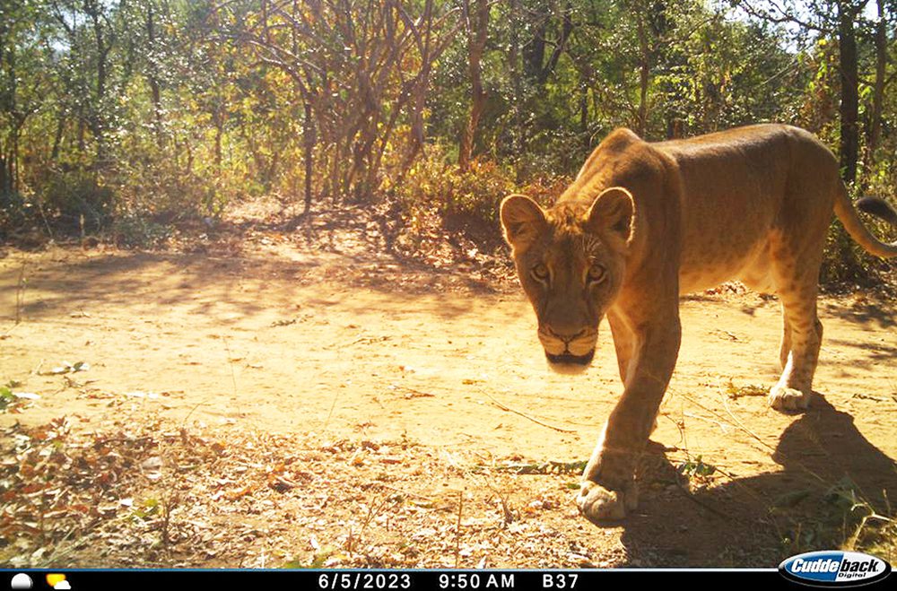
MorphoCam builds open-source AI pipelines that turn ordinary camera trap images into metric measurements: how far away an animal is, how tall it is, and what its body looks like in 3D. The goal is faster, non-invasive density estimation and morphometrics for the unmarked species that most camera trap surveys currently leave behind.

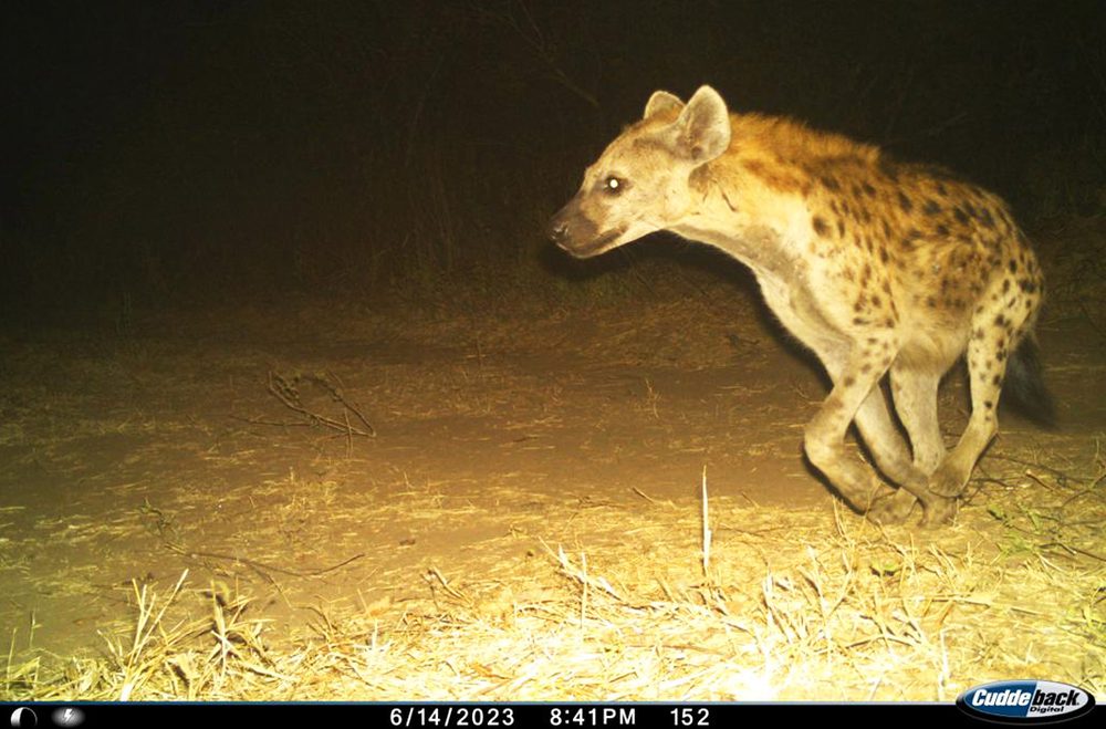
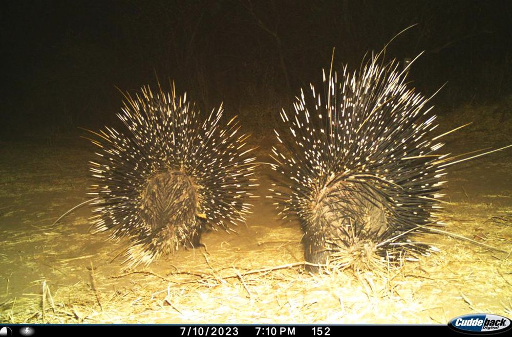
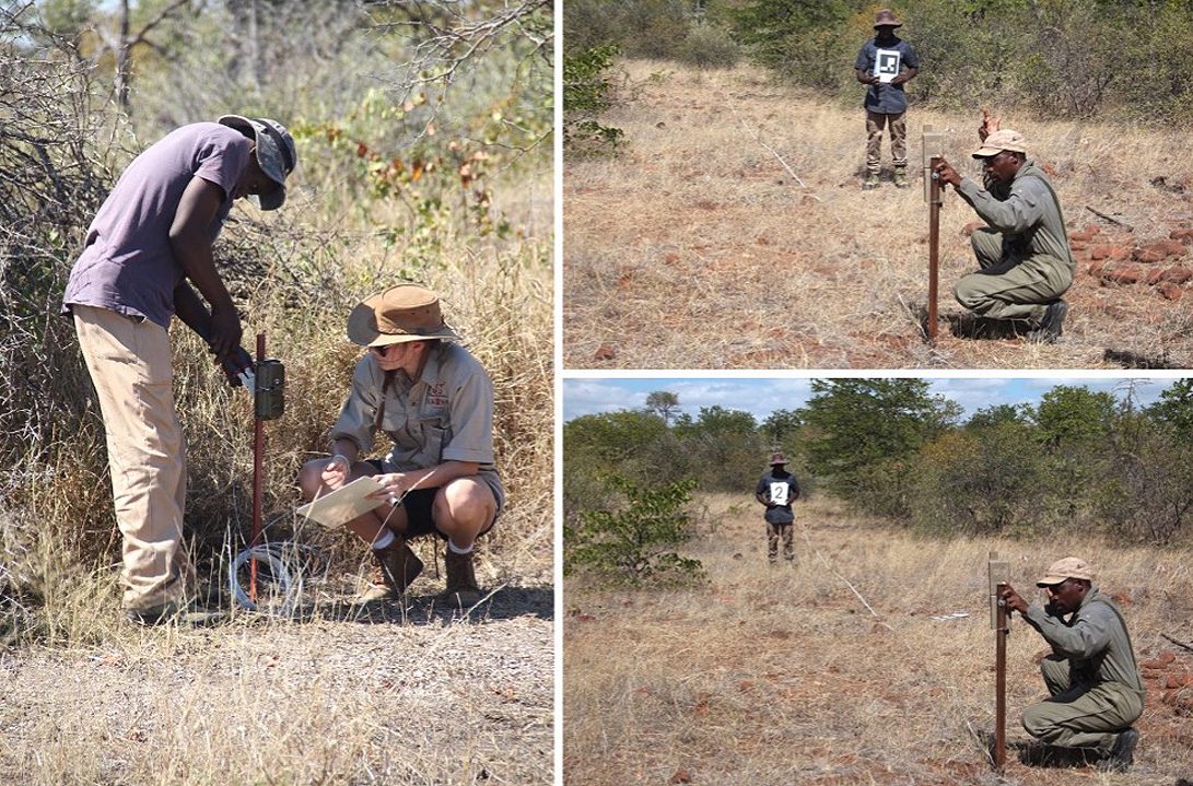
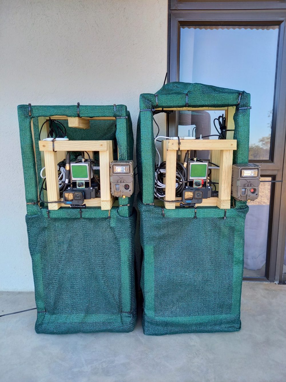
MorphoCam units deployed in Bubye Valley Conservancy, Zimbabwe
2024–2027NERC research grant UKRI037
5peer-reviewed papers & preprints
5open-source repositories (MIT)
127k+synchronised RGB–LiDAR frames released
3field sites in the UK, Zimbabwe & South Africa
About the project

Why measure wildlife from camera traps?

Camera traps are one of the most widely used tools in biodiversity monitoring. They are used to estimate population density, assess the outcomes of conservation interventions, and evaluate the health of individual animals. Yet analysing the images is slow, and automation has so far mostly helped with removing empty frames and identifying species.

Automated density estimation has only really worked for marked species, such as leopards, whose coat patterns let individuals be recognised. Most animals that walk past a camera are unmarked. For them, distance sampling is the method of choice, but it needs the distance from the camera to each animal, which has traditionally required laborious manual calibration in the field.

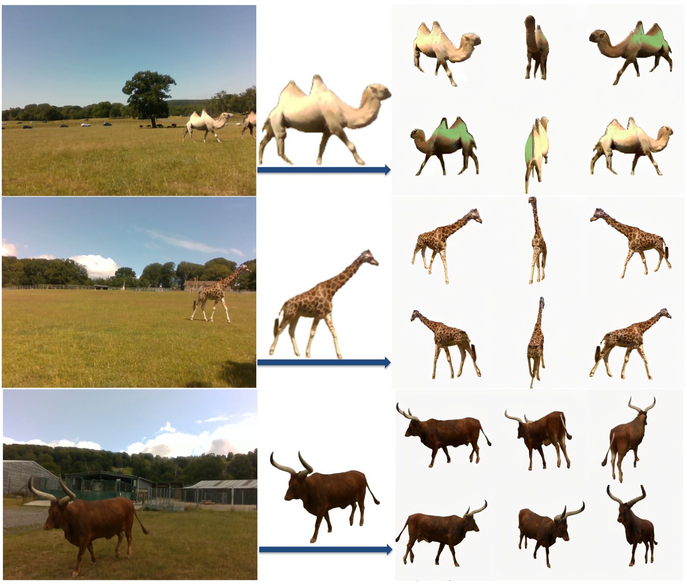
MorphoCam, led by Oxford's Wildlife Conservation Research Unit (WildCRU) with the Department of Computer Science, is developing a software pipeline that estimates that distance automatically using monocular depth estimation, calibrates it to real-world metres, and extends the same machinery to body measurements and 3D reconstruction. Body size and shape can indicate age and condition, which helps researchers understand the demographic structure and health of a population. Everything is released as open source and is being integrated into the WildEye Conservation TrapTagger platform so that species classification, distance estimation and measurement form one end-to-end workflow.

Field team placing calibration markers at known distances in front of a camera trap in African savanna
Setting up a camera trap and distance calibration markers in the field. Photo: WildCRU.
Approach

Three work packages

The project combines user research with camera trap practitioners, new computer vision methods, and practical tools that ecologists can run on their own data.

01

Research community engagement

Consulting camera trap researchers before design begins so the tools solve real bottlenecks in survey workflows, and reporting results back to the community through presentations and open releases.

02

Advancing depth estimation

Benchmarking and improving monocular depth estimation models for wildlife scenes, developing automated reference-object calibration to metric scale, and collecting synchronised RGB, LiDAR and radar ground truth to validate image-only models at range.

03

Interfaces for distance sampling & morphometrics

Building user-friendly desktop and command-line tools for manual and automated measurement, pose-based 3D reconstruction of animals, and integrating the outputs into TrapTagger with WildEye Conservation.

From a photo to metres

The core MorphoCam pipeline processes every image at a camera station in five steps. No laser rangefinder, calibrated rig or reliable EXIF metadata is required.

Calibrate

Photos of reference objects at known distances are used to fit a monotonic curve mapping the depth model's relative output to metric depth, per camera station.

Detect

Animals (and optionally people and vehicles) are located with MegaDetector, or imported from TrapTagger exports.

Segment

Segment Anything isolates each animal from background and occluding vegetation with a pixel-accurate mask.

Estimate depth

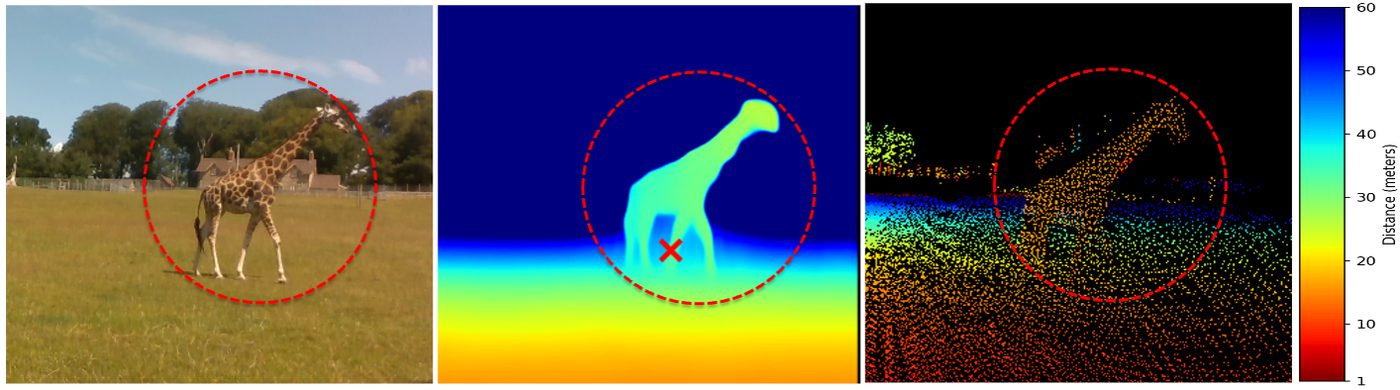
A monocular depth model (DPT, MiDaS 3.1, Depth Anything, Depth Pro, Metric3D v2, UniDepthV2 and others) predicts depth for the whole frame.

Measure

A representative depth per animal is combined with its pixel position and the camera's field of view to give radial distance and height, written to CSV for distance sampling.

Software

Open-source tools

All MorphoCam code is released under the MIT licence on the Morphocam GitHub organisation. Desktop GUIs are provided for Windows, macOS and Linux alongside command-line interfaces for scripted runs.

Flagship GUI + CLI

Depth-Estimation

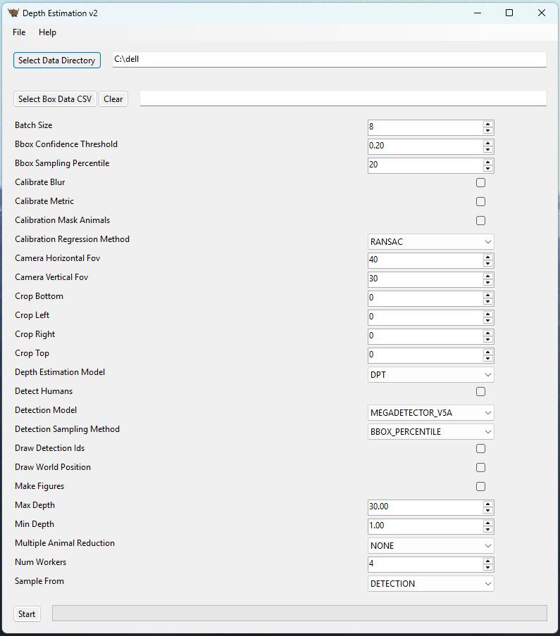
Official implementation of the Ecological Informatics paper. Turns raw camera trap photos into metric camera-to-animal distances and heights by combining MegaDetector, Segment Anything and a choice of monocular depth backbones with automated reference-object calibration. Outputs per-station CSV files ready for distance-sampling density analysis, plus diagnostic figures.

Integration

depth-estimation-traptagger

The depth estimation pipeline packaged for integration with WildEye Conservation's TrapTagger platform, so that distance outputs appear alongside species classifications in an existing camera trap workflow.

Morphometrics GUI + CLI

Morpho3D

A desktop application that turns photographs into 3D meshes, putting nine state-of-the-art image-to-3D generators (including TripoSR, TRELLIS and Hunyuan3D) behind one interface. Supports single-image and multi-view input, runs entirely on a local GPU, and exports .glb meshes for morphometric analysis.

Individual ID

Animals Gaits Analysis

Video-based pipeline for identifying individual animals from how they move. Animals are segmented with SAM, encoded through complementary appearance (ResNet18) and motion (VideoPrism) streams, and clustered by cosine similarity. No collars, tags or handling required.

Benchmark

wilddepth-v2

Code and experiment scripts for WildDepth-v2: radar-to-LiDAR calibration, Doppler motion transfer, metric 3D tracking with a Kalman smoother, and the frozen hidden benchmark for RGB-only distance estimation and RGB + sparse-LiDAR depth completion. Every number in the paper maps to a script and a results file.

Screenshot of the Depth-Estimation desktop application
The Depth-Estimation desktop GUI.
Datasets

WildDepth: metric ground truth for wildlife

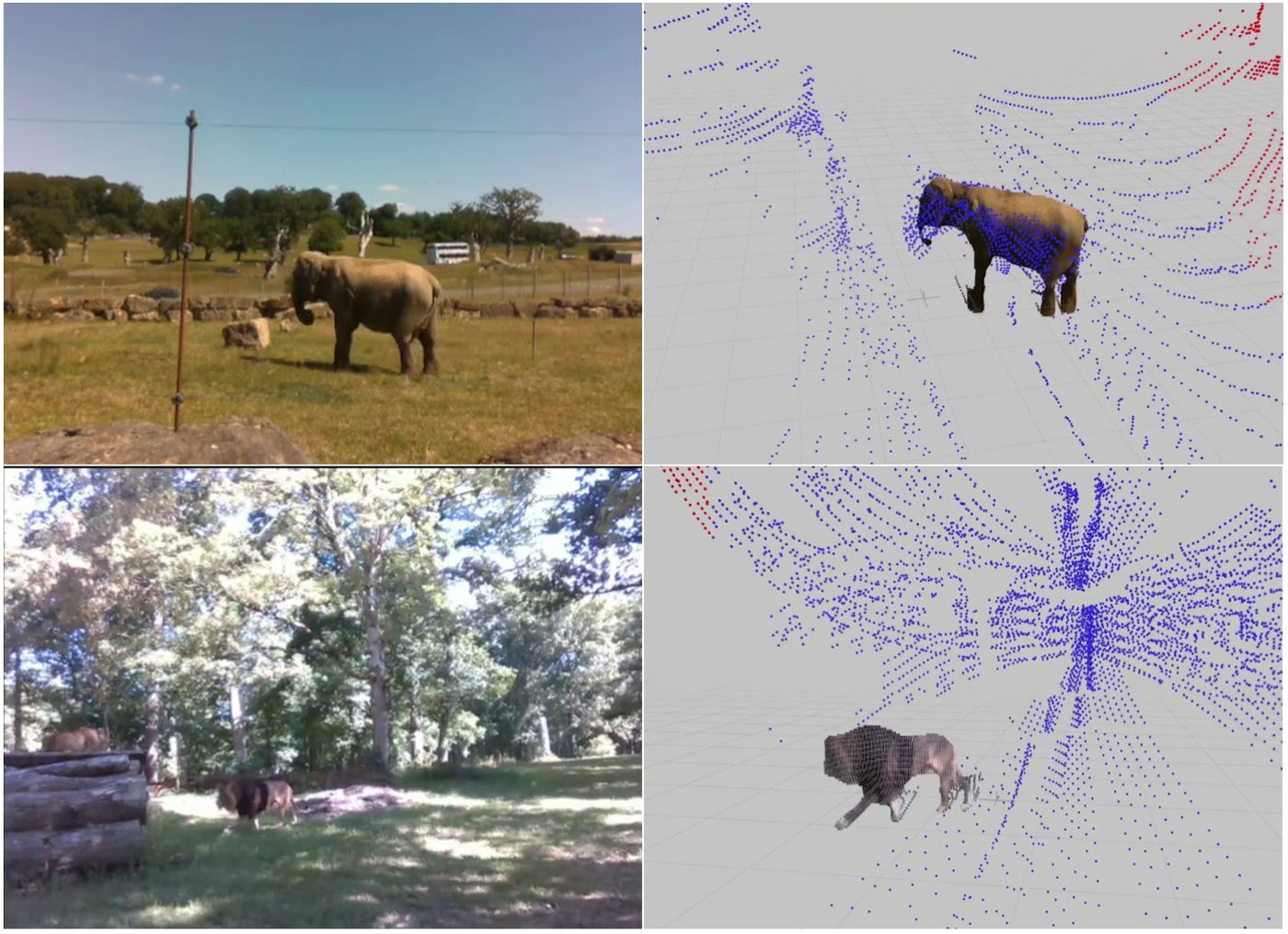
Most animal-focused vision models are trained on data without metric scale, which makes image-only methods hard to validate. WildDepth is a multimodal dataset and benchmark suite with synchronised RGB and LiDAR (and, in version 2, imaging radar) recordings of animals from domestic to wild settings. Full details, video galleries and downloads are on the WildDepth project page.

SiteCountryContentSensorsDownload
Bubye Valley ConservancyZimbabwe6 species including giraffe, zebra and warthog; 84,700 synchronised frames from stationary MorphoCam unitsRGB + Livox Mid-70 LiDARPart 1 (46 GB) · Part 2 (38 GB)
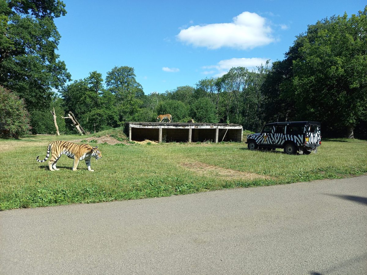
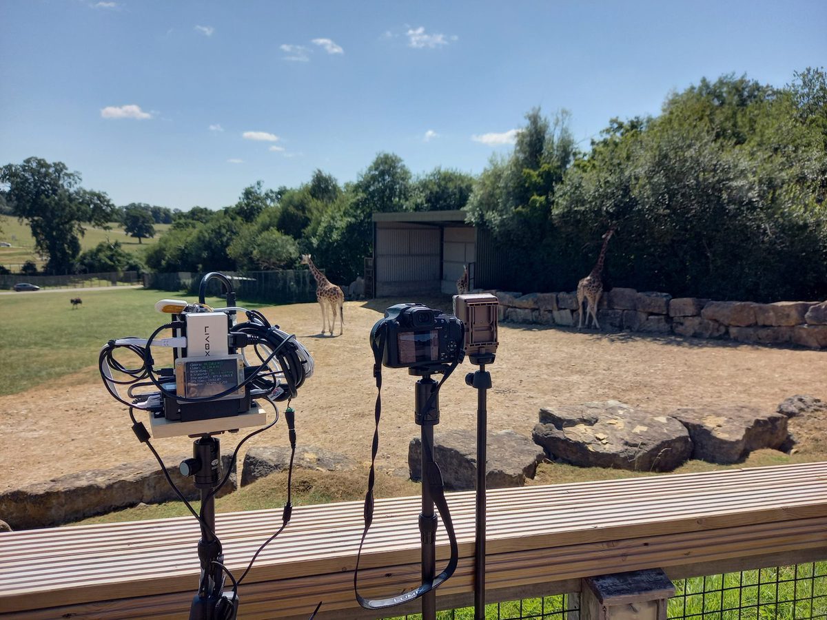
Longleat Safari ParkUnited Kingdom10+ species with diverse body morphologies in a controlled setting; 42,500 synchronised framesRGB + Livox Avia LiDARv1 (42 GB) · v2 Part 1 (38 GB) · v2 Part 2 (21 GB)
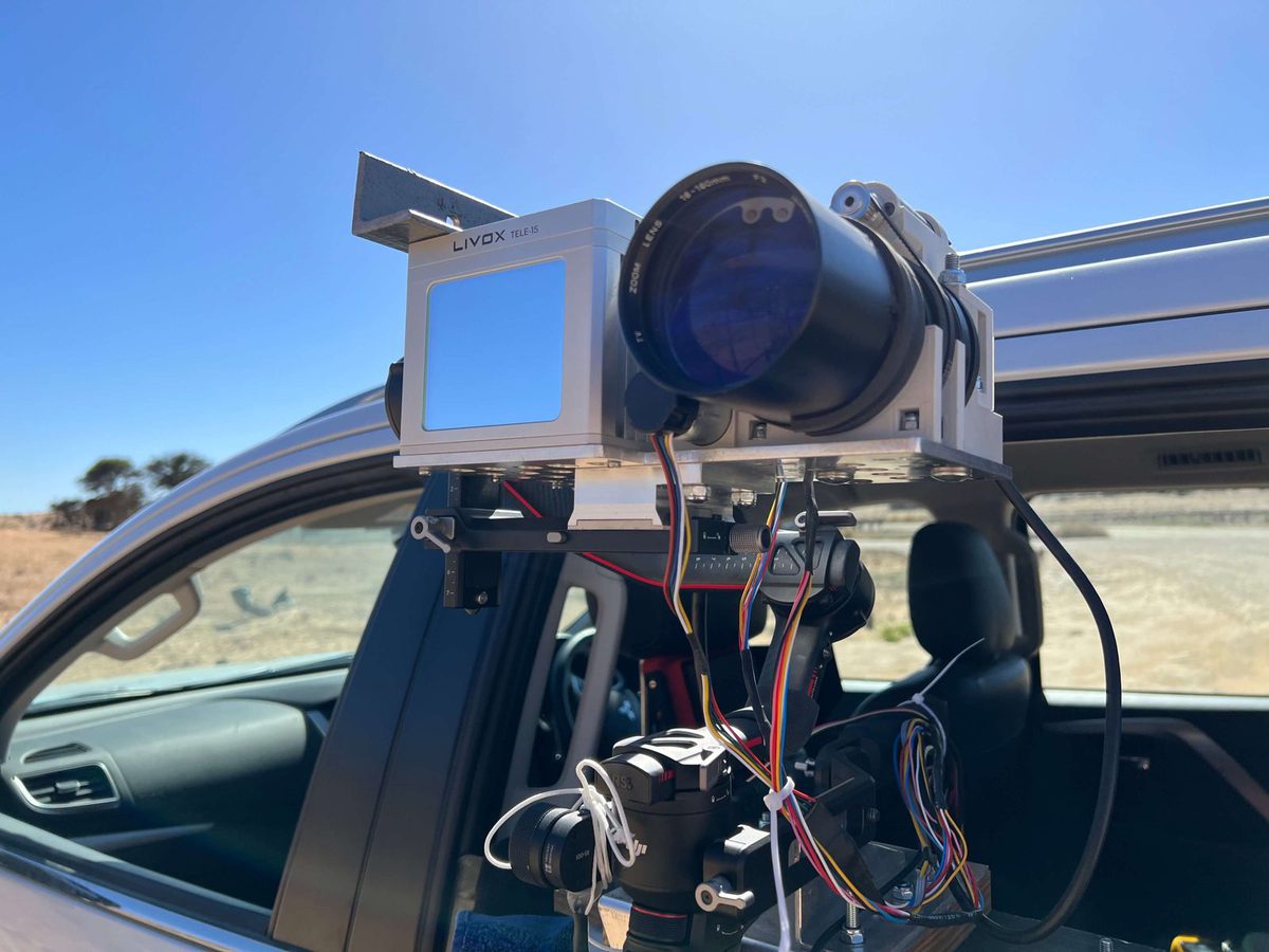
Kgalagadi Transfrontier ParkSouth AfricaApex predators and large herbivores (lion, cheetah, leopard, springbok, gemsbok) from a 13-day survey with the vehicle-mounted WildPose systemZoom RGB + LiDARRaw data · Videos
WildDepth-v2 radar subsetUnited Kingdom37 RGB–LiDAR–4D radar sequences (19,716 frames) with per-point Doppler velocity, metric 3D animal trajectories and a hidden benchmark test setRGB + LiDAR + imaging radarPreprint · Code
Calibration ground truthUnited KingdomGround-truth imagery for validating monocular depth estimation models outdoors, collected at WildCRU's research base at Tubney House, OxfordshireCamera trap RGBDescribed in paper
Publications

Papers from the project

Journal articles, conference papers and preprints produced by MorphoCam. A BibTeX file with all entries is available as papers.bib.

2026Preprint

WildDepth-v2: A Synchronized RGB–LiDAR–Radar Dataset and Benchmark for Metric Depth, Motion, and Tracking of Wildlife

Muhammad Aamir, Sangyun Shin, Naoya Muramatsu, Matthew Wijers, Amir Patel, Andrew Loveridge, Andrew Markham
arXiv:2610.31123, October 2026. Journal extension of WildDepth (ECCV 2026).
Abstract

Measuring animal distance and motion in metric units underpins abundance estimation, morphometrics, and movement ecology, yet monocular video lacks metric scale and wildlife datasets lack metric ground truth. We present WildDepth 2, extending the synchronized RGB-LiDAR WildDepth dataset in three directions. (i) Imaging radar: 37 RGB-LiDAR-4D-radar sequences (19,716 frames) with per-point Doppler velocity and a measured error budget, to our knowledge the first imaging-radar wildlife recordings. (ii) Benchmarking: a frozen, checksummed hidden test set for RGB-only distance estimation and RGB+sparse-LiDAR depth completion, evaluated separately on animal and background pixels. (iii) Motion and tracking: metric 3D trajectories obtained by lifting 2D tracks using LiDAR, radar, or monocular depth. Across 48,723 animal frames, object-level radar calibration improves monocular depth over scene-level LiDAR calibration without requiring LiDAR at inference (AbsRel 0.120 vs. 0.198), although animal-level LiDAR remains more accurate (0.052). Across 431 tracks, once-per-track radar scaling reduces 3D position error four-fold (2.20 to 0.58 m) and distance-sampling detection-function bias from −13% to −2%, matching once-per-track LiDAR calibration. Transferring radar Doppler onto LiDAR produces motion masks 3.7 times denser than radar alone at 72% precision, reduces moving-animal LiDAR accumulation error by 37%, and estimates radial speed (r = 0.60), albeit with approximately 50% underestimation.

BibTeX
@article{aamir2026wilddepthv2,
  title   = {WildDepth-v2: A Synchronized RGB--LiDAR--Radar Dataset and Benchmark for Metric Depth, Motion, and Tracking of Wildlife},
  author  = {Aamir, Muhammad and Shin, Sangyun and Muramatsu, Naoya and Wijers, Matthew and Patel, Amir and Loveridge, Andrew and Markham, Andrew},
  journal = {arXiv preprint arXiv:2610.31123},
  year    = {2026},
  doi     = {10.48550/arXiv.2610.31123}
}

2026Conference

WildDepth: A Multimodal Dataset for 3D Wildlife Perception and Depth Estimation

Muhammad Aamir*, Naoya Muramatsu*, Sangyun Shin*, Matthew Wijers, Jia-Xing Zhong, Xinyu Hou, Amir Patel, Andrew Loveridge, Andrew Markham (* equal contribution)
Computer Vision – ECCV 2026, Lecture Notes in Computer Science vol. 17042, pp. 40–58. Springer. European Conference on Computer Vision, Malmö, Sweden, 8–12 September 2026.
Abstract

Depth estimation and 3D reconstruction have been extensively studied as core topics in computer vision. Starting from rigid objects with relatively simple geometric shapes, such as vehicles, the research has expanded to address general objects, including challenging deformable objects, such as humans and animals. In particular, for the animal, however, the majority of the existing models are trained based on datasets without metric scale, which can help validate image-only models. To address this limitation, we present WildDepth, a multimodal dataset and benchmark suite for depth estimation, behavior detection, and 3D reconstruction from diverse categories of animals ranging from domestic to wild environments with synchronized RGB and LiDAR. Experimental results show that the use of multi-modal data improves depth reliability by up to 10% RMSE, while RGB–LiDAR fusion enhances 3D reconstruction fidelity by 12% in Chamfer distance. By releasing WildDepth and its benchmarks, we aim to foster robust multimodal perception systems that generalize across domains.

BibTeX
@inproceedings{aamir2026wilddepth,
  title        = {WildDepth: A Multimodal Dataset for 3D Wildlife Perception and Depth Estimation},
  author       = {Aamir, Muhammad and Muramatsu, Naoya and Shin, Sangyun and Wijers, Matthew and Zhong, Jia-Xing and Hou, Xinyu and Patel, Amir and Loveridge, Andrew and Markham, Andrew},
  booktitle    = {Computer Vision -- ECCV 2026},
  series       = {Lecture Notes in Computer Science},
  volume       = {17042},
  pages        = {40--58},
  year         = {2026},
  publisher    = {Springer},
  doi          = {10.1007/978-3-032-37422-6_3}
}
2026Preprint

A non-invasive video-based method for individual identification of wildlife using gait dynamics

Muhammad Aamir, Matthew Wijers, Sangyun Shin, Andrew Loveridge, Andrew Markham
arXiv:2607.04518, July 2026. Under review at Methods in Ecology and Evolution.
Abstract

Gait is a distinctive behavioral characteristic that enables non-invasive individual identification without requiring physical interaction with an animal. While gait-based analysis has been extensively studied in humans, its application to wildlife remains limited due to environmental variability and the lack of scalable identification methods. This paper presents a fully automated, video-based pipeline for wildlife gait analysis and individual identification using deep spatiotemporal representation learning. The proposed pipeline uses the Segment Anything Model 3 (SAM3) to generate high-quality RGB and binary silhouette masks, robustly isolating animals from complex natural backgrounds. Segmented video sequences are processed using a convolutional neural network (ResNet18) for spatial feature extraction and a transformer-based video model (VideoPrism) for temporal motion modeling. Both models are fine-tuned using a classification objective and subsequently used as feature extractors to generate discriminative gait representations. Cosine similarity is then used to compare gait signatures, enabling similarity-based clustering of individuals without reliance on physical markings or invasive tagging. Experiments conducted on multi-source wildlife video data across multiple species demonstrate strong intra-individual consistency and clear inter-individual separation. Quantitative results using cosine similarity distributions and silhouette scores confirm the effectiveness of the proposed method. These findings demonstrate that gait dynamics provide a viable, non-invasive approach for individual identification in wildlife and highlight the potential of video-based deep learning pipelines for scalable ecological monitoring.

BibTeX
@article{aamir2026gait,
  title   = {A non-invasive video-based method for individual identification of wildlife using gait dynamics},
  author  = {Aamir, Muhammad and Wijers, Matthew and Shin, Sangyun and Loveridge, Andrew and Markham, Andrew},
  journal = {arXiv preprint arXiv:2607.04518},
  year    = {2026},
  doi     = {10.48550/arXiv.2607.04518}
}
2025Journal

A robust metric distance and height estimation pipeline for wildlife camera trap imagery

Muhammad Aamir, Matthew Wijers, Andrew Loveridge, Andrew Markham
Ecological Informatics, Volume 92, 103520, December 2025. Open access (CC BY 4.0).
Abstract

Obtaining accurate metric measurements from 2D images captured by camera traps is valuable for ecological research, particularly population density estimation and morphometric analyses. Traditional methods require extensive manual calibration and image processing, making large-scale studies impractical. In this research study, we present a robust and automated pipeline that integrates monocular depth estimation (MDE) models with automated calibration and animal detection methods. Our pipeline uses deep learning based MDEs, including Dense Prediction Transformers (DPT), MiDaS 3.1, DepthAnything, DepthPro and UniDepthV2, along with multiple calibration methods such as linear, polynomial, and piecewise regression, to improve distance estimation accuracy. We introduce an automated mask generation and cross-camera calibration process to reduce manual effort. The proposed pipeline was validated using controlled ground truth data collected in Oxfordshire, UK, and subsequently tested on real-world wildlife data from the Bubye Valley Conservancy, Zimbabwe. Our proposed technique using UniDepthV2 MDE and piecewise linear regression for calibration reduces overall distance estimation error by up to 35% compared to existing approaches. Furthermore, we implemented height estimation as an indirect validation mechanism, presenting a correlation between true and estimated heights for different animals. Our fully automated pipeline advances camera trap-based wildlife monitoring, reducing human effort while improving scalability and reliability for conservation research.

BibTeX
@article{aamir2025robust,
  title   = {A robust metric distance and height estimation pipeline for wildlife camera trap imagery},
  author  = {Aamir, Muhammad and Wijers, Matthew and Loveridge, Andrew and Markham, Andrew},
  journal = {Ecological Informatics},
  volume  = {92},
  pages   = {103520},
  year    = {2025},
  doi     = {10.1016/j.ecoinf.2025.103520}
}
2025Journal

WildPose: a long-range 3D wildlife motion capture system

Naoya Muramatsu, Sangyun Shin, Qianyi Deng, Andrew Markham, Amir Patel
Journal of Experimental Biology, Volume 228, Issue 5, JEB249987, March 2025. The first study of the Oxford–Cape Town collaboration.
Abstract

Understanding and monitoring wildlife behavior is crucial in ecology and biomechanics, yet challenging because of the limitations of current methods. To address this issue, we introduce WildPose, a novel long-range motion capture system specifically tailored for free-ranging wildlife observation. This system combines an electronically controllable zoom-lens camera with a LiDAR to capture both 2D videos and 3D point cloud data, thereby allowing researchers to observe high-fidelity animal morphometrics, behavior and interactions in a completely remote manner. Field trials conducted in Kgalagadi Transfrontier Park (South Africa) have successfully demonstrated WildPose's ability to quantify morphological features of different species, accurately track the 3D movements of a springbok herd over time, and observe the respiratory patterns of a distant lion. By facilitating non-intrusive, long-range 3D data collection, WildPose marks a significant complementary technique in ecological and biomechanical studies, offering new possibilities for conservation efforts and animal welfare, and enriching the prospects for interdisciplinary research.

BibTeX
@article{muramatsu2025wildpose,
  title   = {WildPose: a long-range 3D wildlife motion capture system},
  author  = {Muramatsu, Naoya and Shin, Sangyun and Deng, Qianyi and Markham, Andrew and Patel, Amir},
  journal = {Journal of Experimental Biology},
  volume  = {228},
  number  = {5},
  pages   = {JEB249987},
  year    = {2025},
  doi     = {10.1242/jeb.249987}
}
Team

People

MorphoCam is a collaboration between the Wildlife Conservation Research Unit (WildCRU) in Oxford's Department of Biology and the Department of Computer Science, with partners in South Africa and the UK.

Andrew Loveridge
Prof. Andrew LoveridgePrincipal InvestigatorWildCRU, Department of Biology, University of Oxford
Andrew Markham
Prof. Andrew MarkhamCo-InvestigatorDepartment of Computer Science, University of Oxford
Matthew Wijers
Dr Matthew WijersPostdoctoral Research AssociateWildCRU, Department of Biology, University of Oxford
Muhammad Aamir
Dr Muhammad AamirResearch Fellow & lead developerDepartment of Computer Science, University of Oxford
Sangyun Shin
Dr Sangyun ShinResearcher, 3D perception & datasetsDepartment of Computer Science, University of Oxford
Jia-Xing Zhong
Dr Jia-Xing ZhongCollaborator, WildDepthDepartment of Computer Science, University of Oxford
Xinyu Hou
Dr Xinyu HouCollaborator, WildDepthDepartment of Computer Science, University of Oxford
Naoya Muramatsu
Dr Naoya MuramatsuCollaborator, WildPose & WildDepthUniversity of Cape Town
Amir Patel
Prof. Amir PatelCollaborator, WildPose & WildDepthUniversity of Cape Town & University College London

Partners & funding

WildCRUWildlife Conservation Research Unit, Department of Biology, University of Oxford. Project lead.
Oxford Computer ScienceDepartment of Computer Science, University of Oxford. Computer vision and software.
WildEye ConservationSouth Africa. TrapTagger integration and user interfaces.
NERC / UKRINatural Environment Research Council grant UKRI037, May 2024 – April 2027.
Field sitesBubye Valley Conservancy (Zimbabwe), Longleat Safari Park (UK), Kgalagadi Transfrontier Park (South Africa).
News & timeline

Progress

  • WildDepth-v2 preprint released on arXiv, adding imaging radar, a hidden benchmark and metric 3D tracking. Code published in the wilddepth_v2 repository.

  • WildDepth presented at ECCV 2026 in Malmö, Sweden, and published in Lecture Notes in Computer Science. Dataset downloads released on Zenodo.

  • Gait-based individual identification preprint released on arXiv and submitted to Methods in Ecology and Evolution.

  • The metric distance and height estimation pipeline published open access in Ecological Informatics, with the Depth-Estimation software released on GitHub.

  • Ground-truth calibration imagery collected at Tubney House, Oxfordshire. MorphoCam LiDAR units deployed in Bubye Valley, Zimbabwe; recordings at Longleat Safari Park, UK.

  • WildPose, the first study of the Oxford–Cape Town collaboration, published in the Journal of Experimental Biology. Its long-range zoom camera and LiDAR system recorded wildlife in the Kgalagadi Transfrontier Park, South Africa.

  • Project presented to Department of Biology postgraduate students; community consultation with camera trap researchers begins.

  • Oxford Computer Science announces NERC funding: New funding will leverage AI to analyse camera trap images.

  • MorphoCam begins at WildCRU with NERC grant UKRI037, running to April 2027.

Get involved. MorphoCam is designed around the needs of camera trap practitioners. If you run camera trap surveys and would like to test the tools on your data, or you have feature requests, open an issue on GitHub or contact the team via WildCRU.